|
|
|
|
Synoptic Selected for NOAA ProTech 2.0 Weather Domain Contract |
|
Synoptic has been awarded a position on NOAA’s ProTech 2.0 Weather Domain contract vehicle. With this award, Synoptic can compete to help expand observational coverage, improve data aggregation, and deliver quality-controlled, real-time data into operational workflows.
NOAA’s mission to protect lives and property and support the U.S. economy touches everything from hurricane response and aviation safety to agriculture, energy, and ground transportation. This mission depends heavily on reliable, accessible environmental data. Through ProTech, NOAA and other Department of Commerce (DOC) bureaus can issue task orders to prequalified partners, such as Synoptic, for services including data access and decision support tools.
Synoptic looks forward to supporting NOAA and other DOC efforts to modernize data access and strengthen situational awareness across federal operations.
Read more about this opportunity and view the full details on our News page. |
|
|
|
|
|
Product Spotlight: Snow Depth Now Available |
|
Winter may be winding down, but we're pleased to share that Snow Depth is now fully supported as a variable in Synoptic's Data Viewer and Weather API. The Snow Depth variable provides real-time data for total snow depth reported at each station. Whether you're tracking winter storm impacts, monitoring snowpack, or supporting avalanche safety operations, you can now visualize and access snow depth data alongside all your other surface weather observations. |
|
|
|
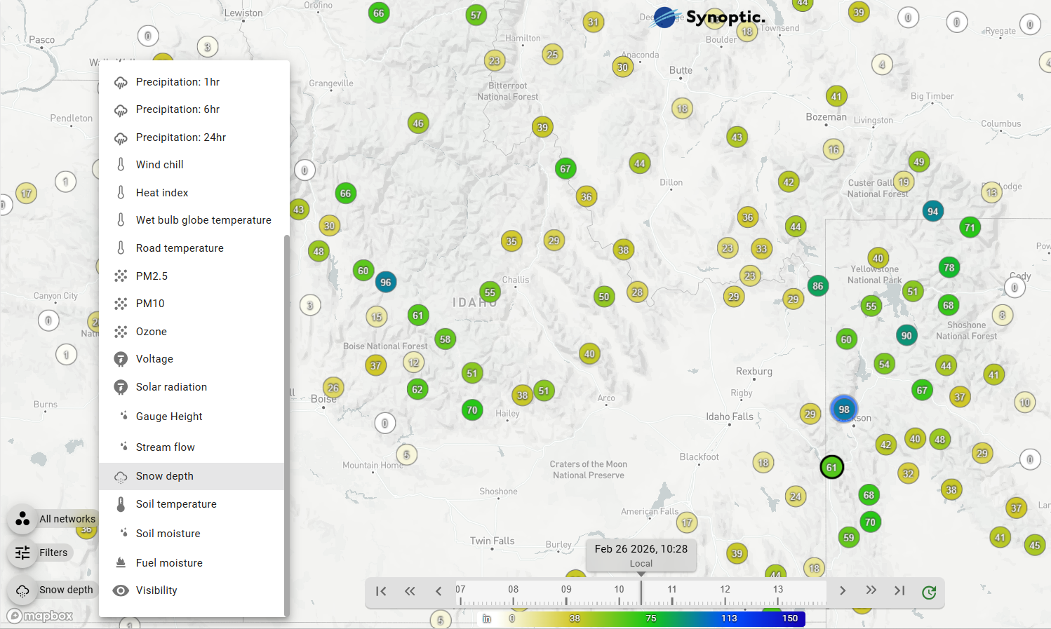
Select Snow Depth from the Menu in the Explore section of the Data Viewer to access real-time Snow Depth data. |
|
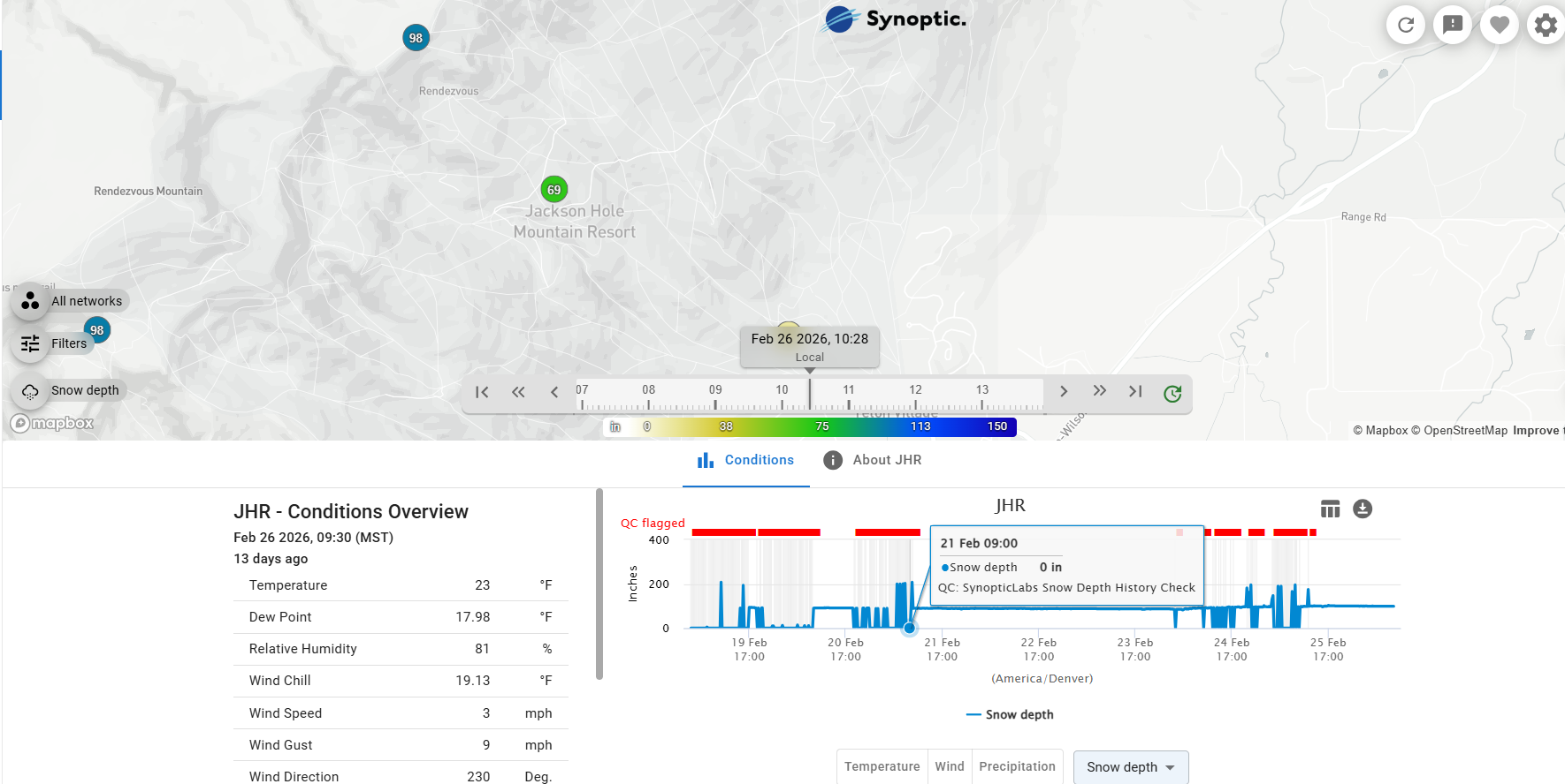
Alongside this launch, we've introduced a new quality control check called the Snow Depth History Check. Anyone who works with snow depth data knows that the sonic sensors used to measure it can occasionally produce erratic readings — especially during high-wind events or when rough surface conditions scatter the signal. These outliers can make it difficult to trust the data at a glance. Our new QC check addresses this by comparing each incoming snow depth reading against a rolling 3-day historical median, flagging values that are obvious outliers from this median. In early testing across stations and networks throughout the U.S., it has proven highly effective at catching spurious spikes. |
|
|
|
Example of Snow Depth QC check for station JHR. Flagged outliers are indicated in red above the timeseries plot. |
|
Ready to explore? Head over to the Synoptic Data Viewer to start visualizing snow depth data across our platform, and see the new quality control in action. Whether you're supporting winter operations, tracking snowpack trends, or just curious about conditions in your region, the data is there and ready for use.
For full documentation on accessing Snow Depth through the Weather API and all available QC options, visit docs.synopticdata.com. |
|
|
|
|
|
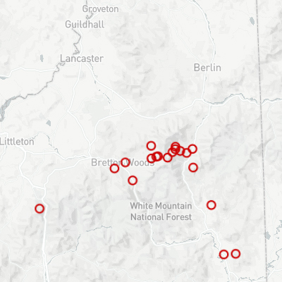
Mount Washington Observatory
The Mount Washington Observatory network provides public access to observations from 26 stations reporting every 15 minutes. The network includes their Summit station, a full METAR station that has been manned and providing data continuously for almost 100 years! The Observatory will be expanding their network over the coming years.
The network provides measurements of temperature, relative humidity, dew point, wind speed and direction, wind gusts, and
additional variables such as visibility, soil temperature, and soil moisture.
|
|
|
|
Previously available only as a restricted dataset, these observations are now accessible to all users through the Synoptic platform. The network provides valuable insight into weather conditions across the region and supports forecasting, research, and operational monitoring in a complex mountain environment.
|
|
|
|
|
|
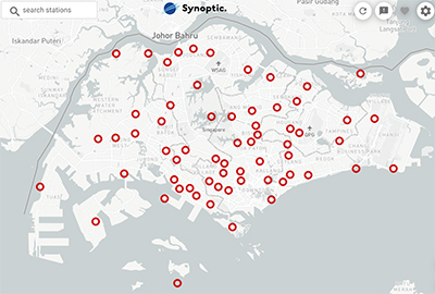
Singapore National Environment Agency
The Singapore National Environment Agency network provides real-time observations from 62 surface stations across Singapore. Stations report every 5 minutes and include measurements of temperature, relative humidity, wind speed/direction, and precipitation, offering high-frequency insights into weather conditions across the country.
|
|
|
|
Integrating this network expands Synoptic’s coverage in Southeast Asia and adds valuable observations from a densely monitored urban and coastal environment. These data support forecasting, research, and operational monitoring while strengthening access to reliable environmental observations in an important global region.
|
|
|
|
|
|
PRIMA
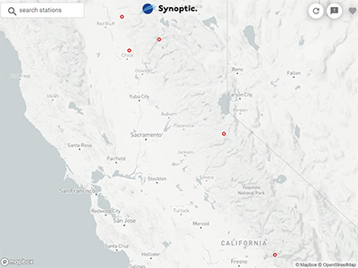
The PRIMA network adds 5 stations in California reporting hourly precipitation and longer accumulation totals. The stations consist of precipitation gauges owned by PG&E and shared with Synoptic through Trinity Consultants, expanding access to utility-relevant environmental observations across the region.
These observations provide additional insight into precipitation conditions that can support
|
|
|
|
situational awareness for utilities and other weather-sensitive operations. Integrating the PRIMA network strengthens regional coverage and provides valuable data for forecasters, researchers, and operational decision-makers monitoring weather impacts in California.
|
|
|
|
|
|
Browse the links below to access helpful tips and documentation for Synoptic's products. |
|
|
|
|
|
|
|
|
|
|
|
|
|
|
|
Copyright © 2026 Synoptic |
|
|
|
|
|