|
|
|
|
Synoptic Selected by the UK Met Office for Weather Data Services |
|
Synoptic has been chosen by the UK Met Office to provide weather and environmental observation data services as part of its ongoing modernization efforts. The Met Office is expanding its real-time third-party weather observations network to support its forecasting, modeling, and climate research activities. |
|
Under this contract, Synoptic will deliver streamlined access to thousands of surface observations across the UK and parts of the wider European area, along with quality control, secure dissemination, visualization, and coordination with multiple network operators. The agreement is structured for two years, with options extending up to five years in total.
|
|
|
|
|
|
Product Spotlight: Precipitation Service |
|
Standardized Precipitation Data |
|
Precipitation is one of the messiest variables in weather data. It is reported in over 20 different formats with varying intervals, units, and reset conventions in the Synoptic system alone. Synoptic’s Precipitation Service was designed to alleviate the problem of inconsistent formats. This service does the normalization
work for you, converting raw data into consistent, quality-controlled intervals and accumulations
through a single API call. The Basic Precipitation Service handles this at each station's native
reporting frequency, while the Advanced Precipitation Service lets you define custom totals and
intervals, such as hourly or multi-year, across any network or region. |
|
|
|
This isn't just a convenience feature. One example of how the service is being used is through
NOAA's National Severe Storms Laboratory and the University of Oklahoma's CIWRO program.
They are using Synoptic's Weather API to feed the Multi-Radar Multi-Sensor (MRMS) system,
which powers flood forecasting and emergency response nationwide. Where their team once
had to stitch together rain gauge data from multiple fragmented sources, they now pull a unified,
quality-controlled feed and remove the manual work of ingesting and decoding while expanding
gauge coverage. |
|
|
|
|
|
|
|
Northern Wasco County Public Utility District (WASCOPUD) |
|
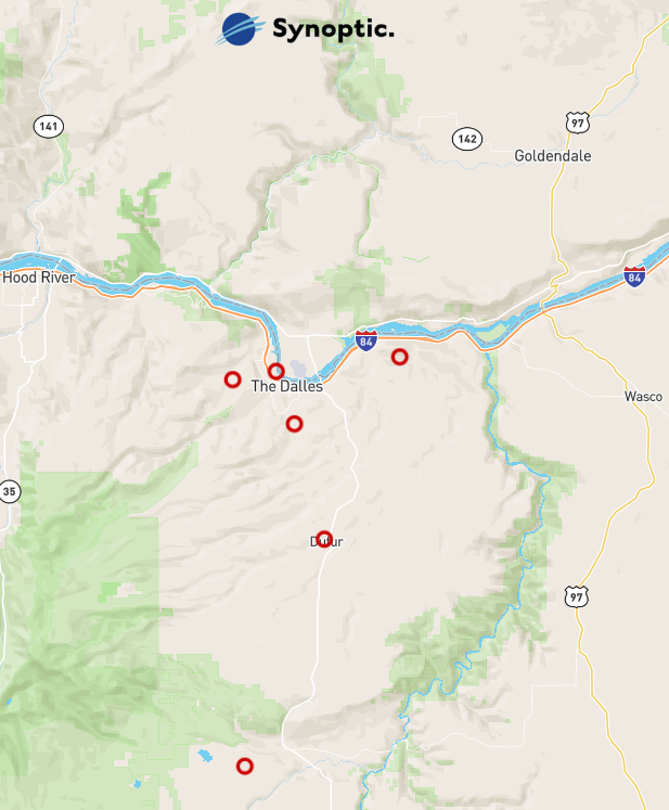
The Northern Wasco County Public Utility District (WASCOPUD) network is now available on the Synoptic platform. This network is located in northern Oregon, and provides observations at six locations in the county’s service territory. The stations report standard meteorological variables such as air temperature, relative humidity, wind data, and precipitation at 1-minute intervals.
The network delivers high-frequency observations that support situational awareness and operational decision-making in a region influenced by complex terrain and rapidly changing weather conditions. These timely observations provide valuable insight for applications ranging from utility operations and wildfire awareness to forecasting, research, and environmental monitoring.
|
|
|
|
|
|
|
|
Yukon Water Science and Stewardship Network |
|
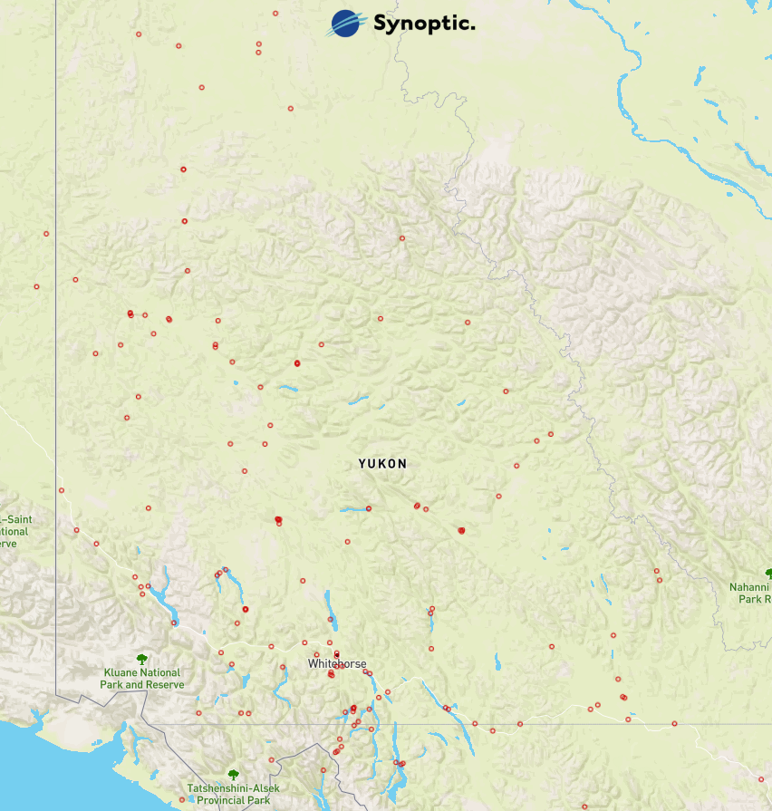
The Yukon Water Science and Stewardship
network is now available on the Synoptic
platform. The network includes
approximately 150 monitoring stations
across the Yukon, providing a
comprehensive view of hydrologic
conditions throughout the territory.
Observations are reported hourly and
include water level, streamflow,
groundwater, snow, and meteorological
data collected through the Government of
Yukon’s long-term water monitoring
programs.
These observations support flood
forecasting, water resource management,
environmental monitoring, research, and
infrastructure planning while expanding
access to critical hydrologic data from one
of Canada's most remote and
environmentally significant regions.
|
|
|
|
|
|
|
|
Browse the links below to access helpful tips and documentation for Synoptic's products. |
|
|
|
|
|
|
|
|
|
|
|
|
|
|
|
Copyright © 2026 Synoptic |
|
|
|
|
|
.jpg)
.jpg)

.png)